I solo backpacked the Cohutta and Big Frog Wilderness areas (Georgia/Tennessee) from 26 AUG to 2 SEPT. Although I grew up camping and backpacking in the Cohutta Wilderness, this was the first time I climbed Big Frog Mountain and explored the Big Frog Wilderness.
I thoroughly enjoyed a week of solitude in nature, and I’d like to share the details of my experience better than a few concise posts on Facebook. I’ll keep my words organized like a journal so that I can share daily highlights.
Day 1 – 26 AUG
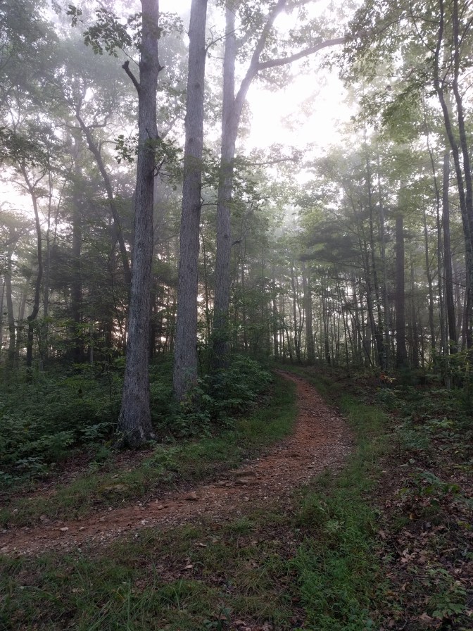
The first day was mostly spent driving to the Three Forks Mountain parking area and hiking about 5 miles of the Rough Ridge Trail to camp at the spring at Crooked Dogwood Gap.
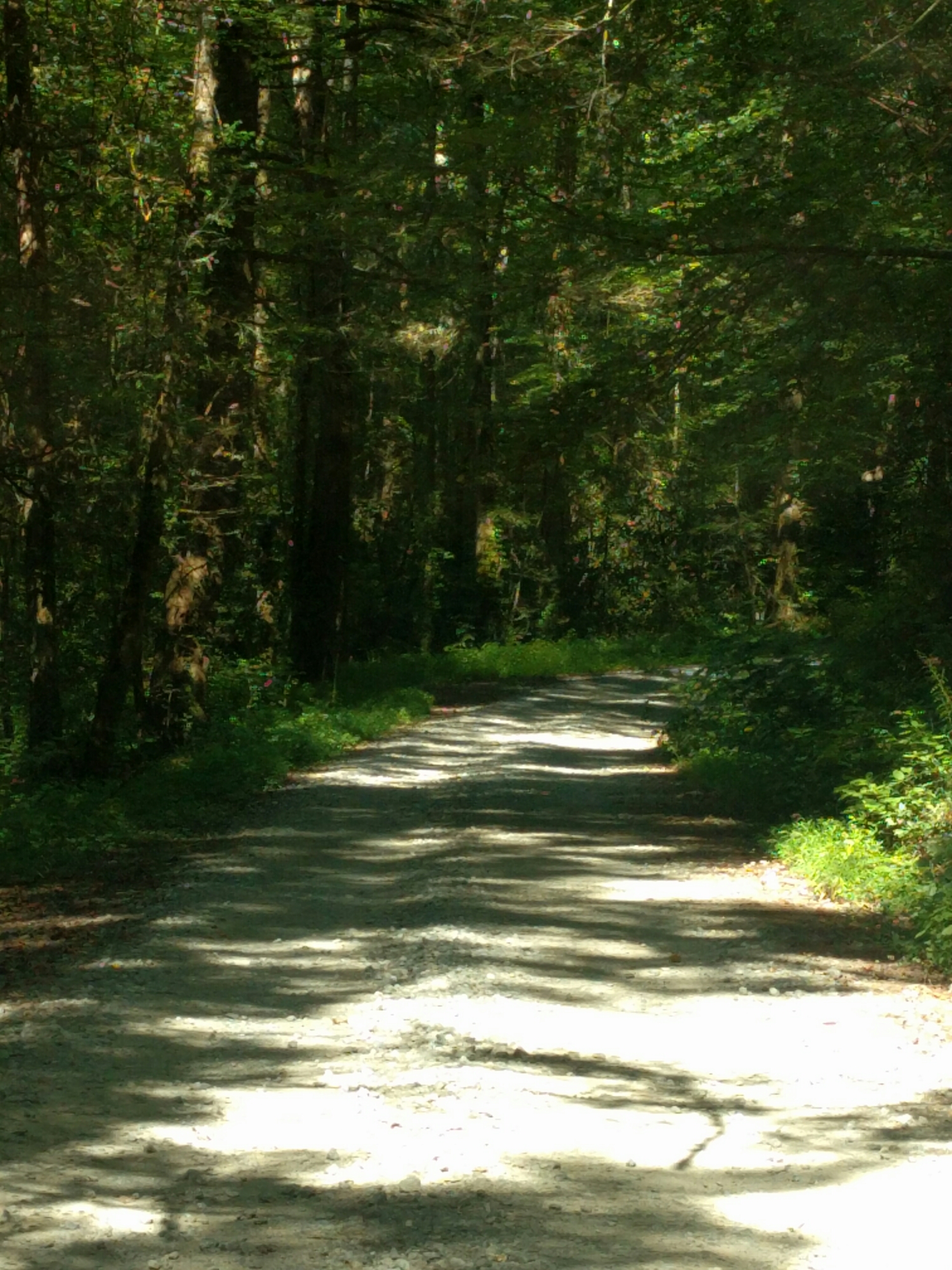
There were several forest road closures due to mudslides earlier in the year, but this didn’t affect my plans to drive up Fort Mountain via the Murray County side of State Hwy 2. After I passed Fort Mountain State Park and the Cohutta Overlook I started looking for Conasauga Road, which delivered me to where the pavement ends and into a sequence of pulse-slowing gravel roads: Shake Rag Road, Wilderness Trail Road, Forest Route 68 and FR 64.
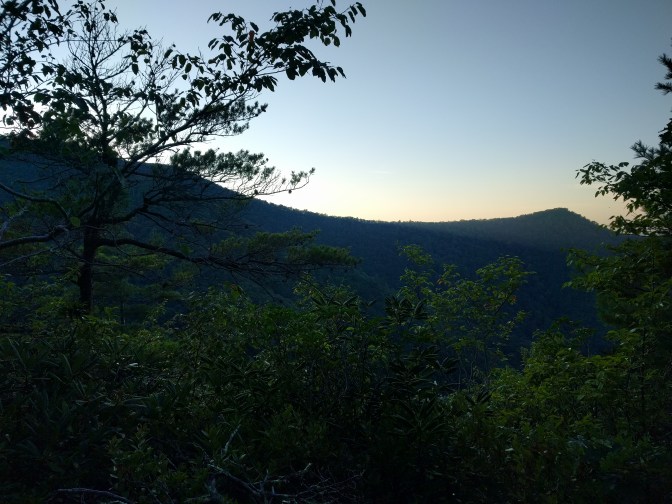
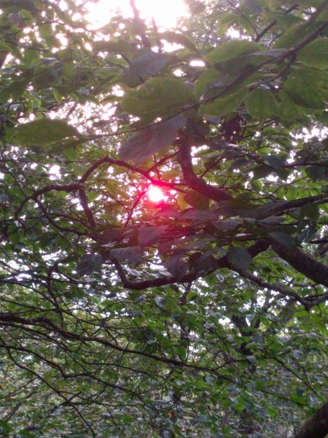
The proper way to take these roads is with all available windows fully down, and once you follow this simple rule, you’ll realize that you were mistaken if you ever called anything other than this particular experience “fresh air”. Pictures do not capture the feel of the cool mountain air on the skin, saturated with the sweet scents of my wilderness home.
I started my hike from the Three Forks Trailhead at 12:30 immersed in the perfect weather for backpacking in an outdoor uniform of t-shirt and shorts. I kept track of my position with a wrist-worn GPS set to report UTM coordinates and the National Geographic Map 777.
Although I don’t think a GPS is necessary in the well-maintained trails of the Cohutta Wilderness, especially since they are so familiar to me, I like to keep track of where I spot something unique, like a bear or the perfect campsite. At minimum, I always carry a cheap Forest Service map ($5) and a compass for navigation.
The 5 miles I hiked along the Rough Ridge Trail were relaxing, and I didn’t have any surprises along the way to report besides collecting enough spider webs on my face to weave an extra pair of hiking socks. By 15:00 I was at the campsite for the night: the spring at Crooked Dogwood Gap.
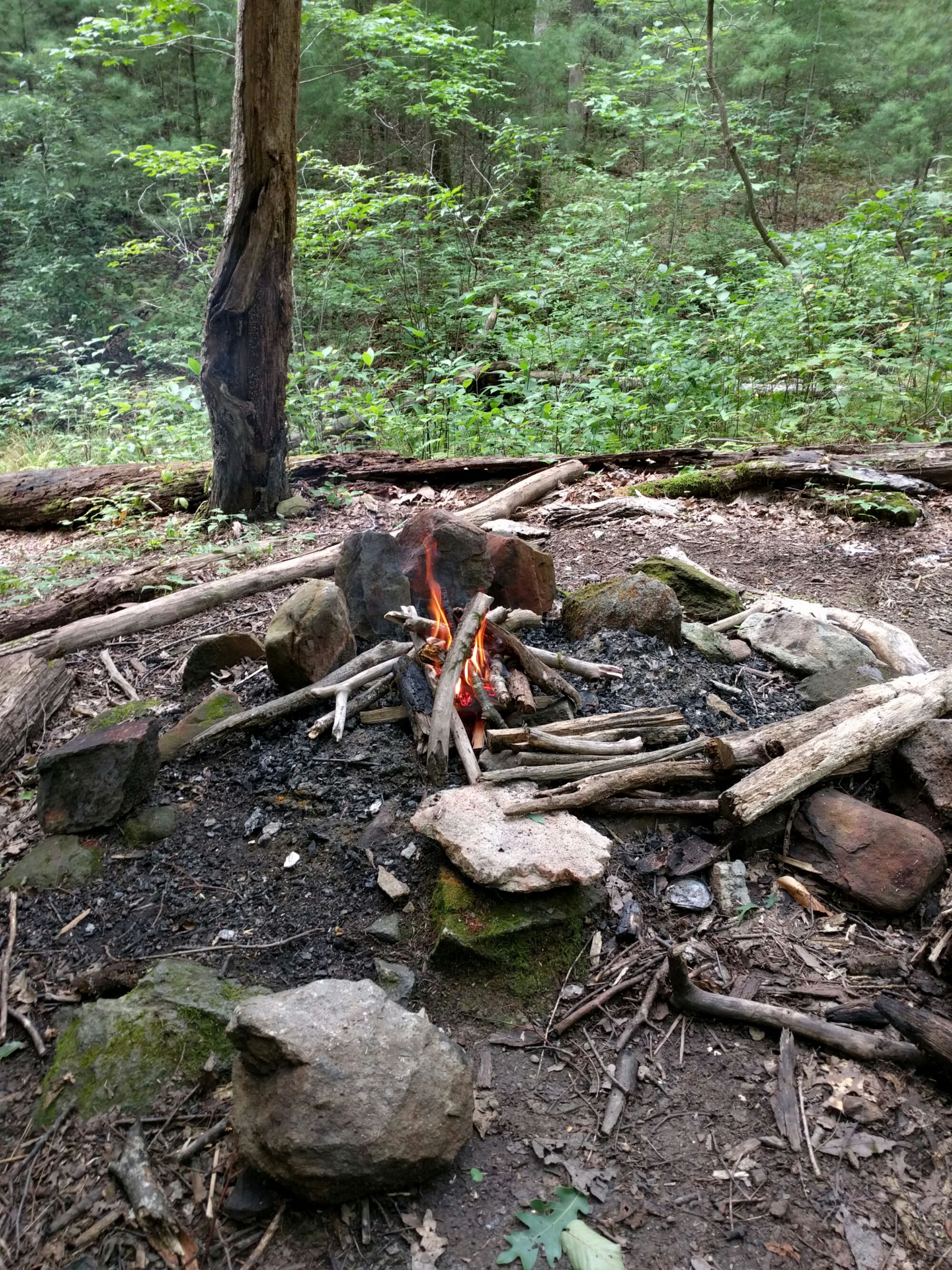
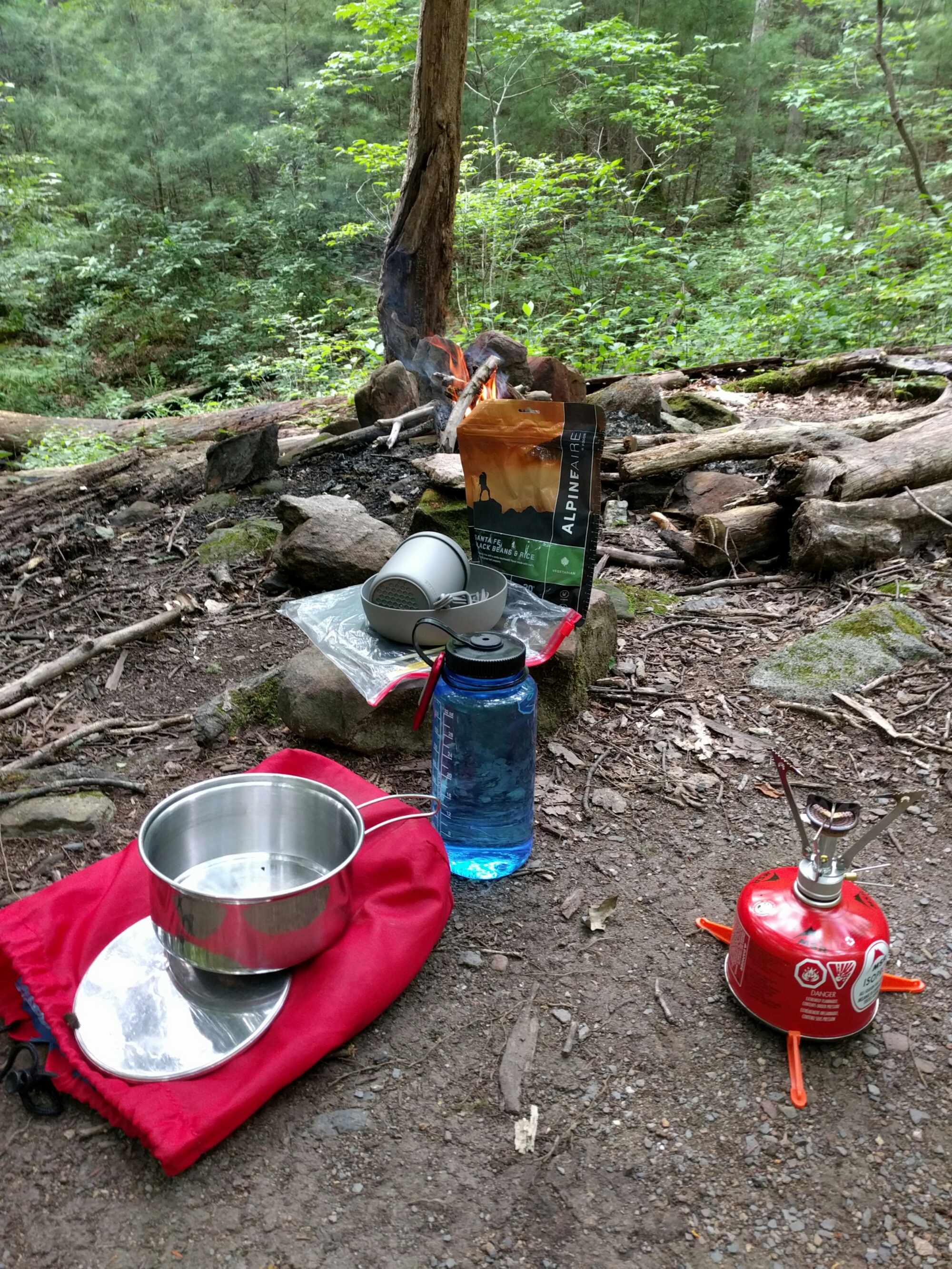
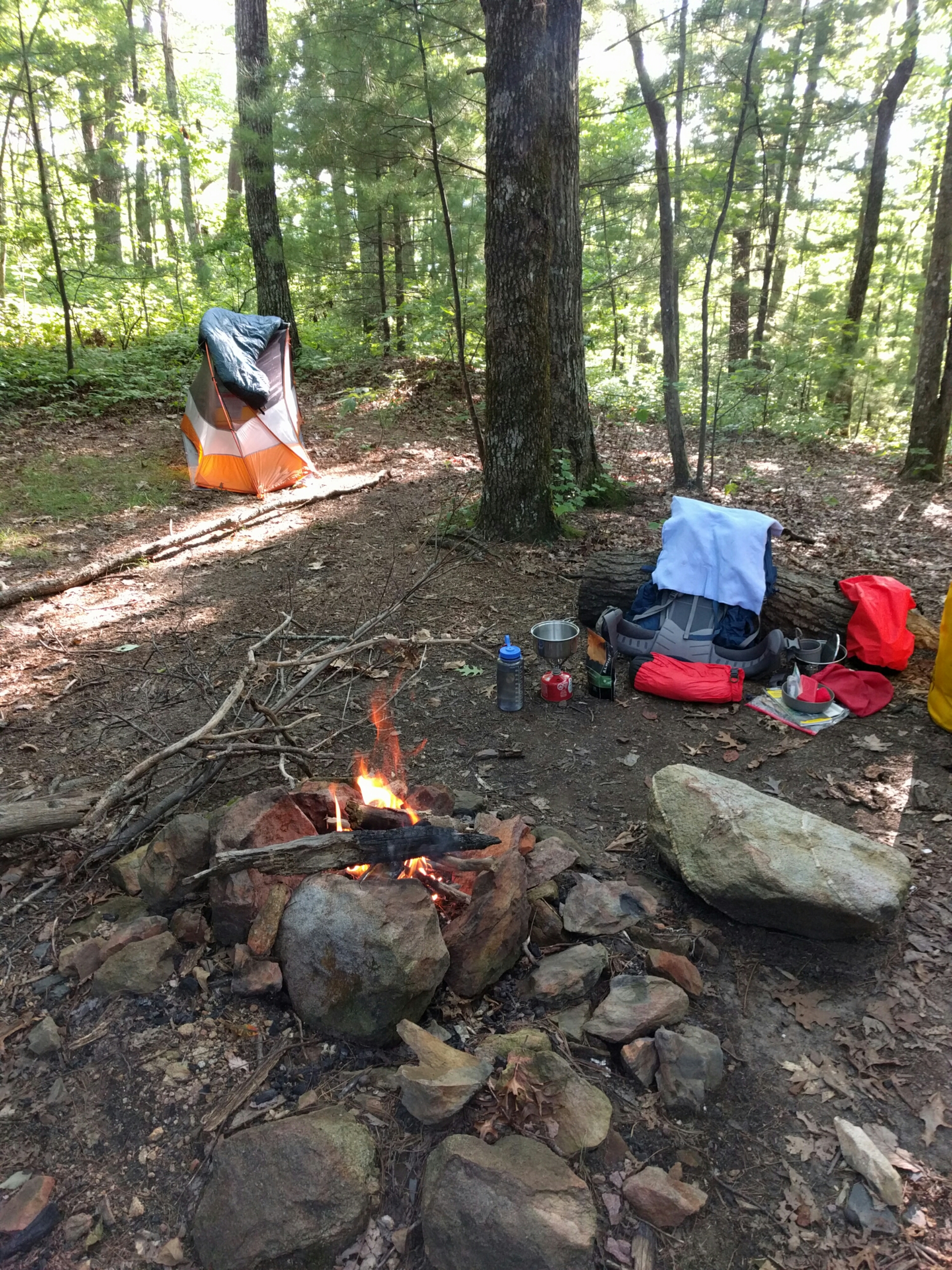
I heard thunder coming from the south when I arrived, so I set up my tent and prepared for a chance of rain. With camp all set I prepared some black beans and rice. Afterwards I developed my own campfire-circling/eating ceremony to ward off the evil spirits that had presently taken the form of curious bees, highly interested in what I was eating.
By dusk I had my food consolidated and hanging from a tree, my water bottles filled with filtered spring water, and my first encounter with rain for the night.
At 20:08 I saw my first bear. I was aware that it was slowly exploring the area near me, but I guess it wasn’t aware that I was present. When the bear was about 40 yards away, I stood up to get a better view of it. That action alone startled it, and it scurried up the hill in a raucous of crunching leaves and snapping twigs.
I was slowly falling to sleep to the loud sounds of insects and frogs in hi-fi stereo by the time a downpour came along at 21:57. I was thankful that I had attached the rainfly to the tent earlier. The rain later subsided, but thunder and lightening continued throughout the night.
Day 2 – 27 AUG
On day 2, I finished Rough Ridge Trail (~2 miles remaining), hiked a section of Jacks River Trail (~1 mile) to connect to Penitentiary Branch Trail, and hiked about 2.5 miles before camping for the night.
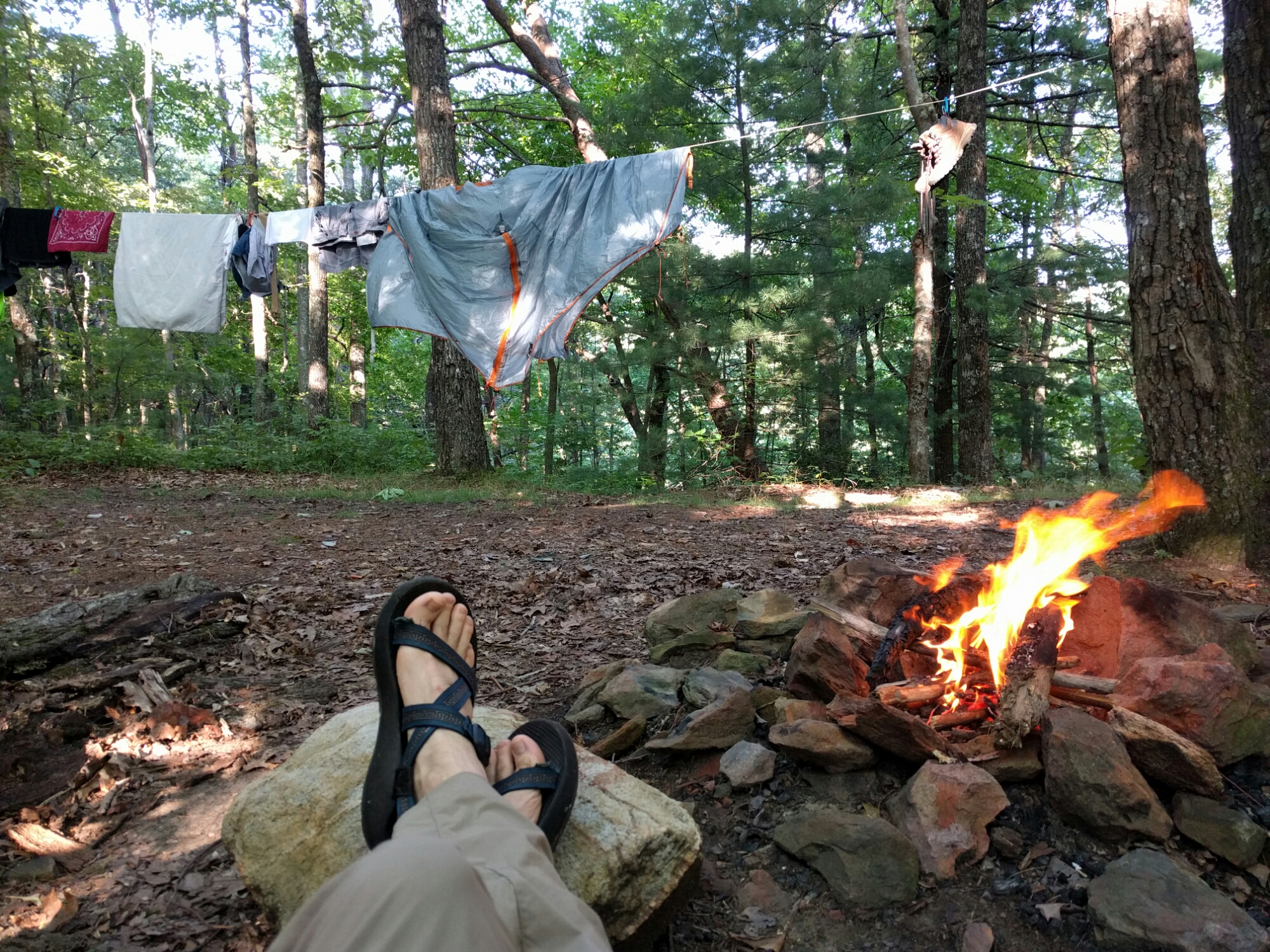
I woke up around 6:00 but didn’t leave the tent until 6:30. I then worked with a headlamp in order to hang a few things, including my tent rainfly, on the clothesline I fashioned from a cord tied between two trees. By 7:08 there was enough light for me to put away the headlamp and focus on preparing a breakfast of oats and tea.
The bees were there to greet me a good morning, so I dedicated the following words to them in reciprocity:
Bees, Please!
The forest bees
Despite their knees
Would rather annoy
Than aim to please
I finished eating breakfast and repacked all my mostly dry equipment before 9:00. Resembling an oddly-colored and oversized snail, I kicked off my hike at 8:53.
After several short breaks and a descent from 3000′ to 1700′, I stopped for a lunch break at a familiar campsite. It’s an expansive site next to a quiet creek that I used last year, upstream of the junction of Rough Ridge Trail and Jacks River Trail. I took advantage of a large log and fashioned a makeshift recliner by creating a backrest out of my backpack and a seat cushion from my drysack filled with a scant amount of clothes.
I started hiking again at 13:00, and by 13:50 I had reached the junction of Penitentiary Branch and Jacks River Trails. I stopped to refill my water bottles at the last river crossing on Penitentiary Branch Trail, because I knew that was my last opportunity to fetch water until I reached Big Frog Mountain the next day.
Although I didn’t see any unusual wild animals on the trail, I did experience a massive tree crashing down to the forest floor nearby! The sound made me think someone was shooting at first, but after a few creaks and snaps I quickly figured out what was happening. I had never seen a tree so large fall in the woods without a chainsaw being involved.
By 17:00 I had reached my site for the night. I had started the day at about 3000′, hiked down to 1700′ and ended my day at 2700′. The miles aren’t really the issue when it comes to backpacking in this area – it’s the ascending and descending that gets you. Still, you can see I’m not out to break any records at my speed.
I set up my makeshift recliner at my site, built a fire and enjoyed the cool breezes blowing through my camp on the ridge. I even pulled up a rock Ottoman to prop my feet on and enjoyed life for awhile.
By 21:00 I was done for the day. I wrote a few words in my journal before submitting to exhaustion:
I love camping on ridges. When a cool breeze comes, I feel like I’m at home. I realize that when you come to the wilderness, you’re meeting nature on its own terms, so you never know what may happen. However, the chance of the moment I’m experiencing right now makes it worth the risk, in my mind. Tomorrow will bring something different, and I feel confident I will figure it out.
Day 3 – 28 AUG
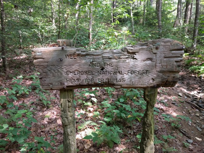
On day 3, I finished Penitentiary Branch Trail (~1 miles remaining) and hiked a section of Hemp Top Trail (~4 miles) to the junction of Big Frog Trail. I camped at the top of Big Frog Mountain for the night. I started the day at 2700′ and ended the day at 4200′.
A cool morning breeze blew through my campsite, so I decided to seize the moment, start packing my belongings at 6:30 and hit the trail as early as possible even though my hips were sore from the previous day’s hike. By 8:00 I was already on my way, and I reached the junction of Penitentiary Branch Trail and Hemp Top Trail at 8:43. At 9:08 I saw my second bear about 40 yards down the ridge from me. Like the first one, it scurried away once it noticed me. I’ve never met a bear out here that has tried anything other than running away from me.
Some parts of Hemp Top Trail were overgrown with wildflowers. Sometimes I hiked through sections of bright yellow that reached past my shoulders. After awhile I stopped to capture a few pictures and eat some lunch. By this point I was already running low on water with slightly over one liter left. This would not be enough for me to hike to the top of the mountain and stay overnight.


I made it to the Georgia/Tennessee border at 11:43, where I saw the first campsite on Hemp Top since I had set foot on the trail. This is the foot of Big Frog Mountain, and the ascent from this point to the top is steep.
There aren’t any springs on Big Frog Mountain, and as I already mentioned, I was low on water. Luckily I was able to dig down into one of the springs here at Double Spring Gap and patiently filter enough water to fill all my bottles. The water had so much sediment that I had to clean the filter after every liter.
I took a long break here to talk with a small group of folks that were day hiking the Benton MacKaye trail up Big Frog Mountain. One gentleman was a volunteer for the Benton MacKaye Trail Association and helped maintain the trails. He handed me a flier to read and encouraged me to hike the Benton MacKaye in the future. Though I didn’t know it at the time, these folks were the last people I was to see in the wilderness on this trip.
Some time around 14:15 I made it to the top of the mountain. I took the climb very slowly, about 15 to 20 steps at a time before stopping for a few seconds to catch my breath. If I hadn’t had a pack on my back I don’t think I would have needed a rest, but I had a significant amount of weight in food and water at this point. Although no one else was staying on the mountain that night, I still found the most secluded site at the southeast part of the mountain top and set up camp there.


I made it to the top just as rain started pouring down. I was quick about setting up my tent and tossing everything inside so that I didn’t have to worry about soaked equipment. In between rains, I finished setting up camp and prepared a warm meal. By the time a second downpour came, I was ready to take a nap in the tent. I couldn’t have been more relaxed, napping in a dry tent while listening to heavy rain supported by a deep bass of thunder.
That evening I thought about how the Cherokee had imagined that the Cohutta mountains served to support the sky. My understanding is that the word “Cohutta” can be translated as “a shed roof supported on poles”. I also had read that the Cherokee held the spring frog in high regard as it had the unique ability to climb and it announced the arrival of spring with its awakening from hibernation. These thoughts led me to imagine the mountain as an old man coming to life after a long winter.
Big Frog Mountain’s Rebirth
The climbing spring frog is reborn
The Old Man weathered through dark storm
The red sun’s spirit rekindled
The Old Man’s quick blood remembered
Keepers of the house support the sky
Life’s work inspired by watchful eye
I reviewed my maps a little before turning in for the night and decided to hike down Big Frog Trail and return to the top of Big Frog Mountain via Licklog Ridge Trail the next day.
Day 4 – 29 AUG
On day 4 I explored the Big Frog Wilderness, hiking a large loop consisting of most of Big Frog Trail (~4 miles), all of Rough Creek Trail (2.9 miles) and most of Licklog Ridge Trail (~4 miles). I camped in the same place I camped the previous night, atop Big Frog Mountain. I started the day at 4200′, descended to 1800′, crossed a ridge on Rough Creek Trail that peaked at 2300′ only to return me to 1800′, and then ended the day at 4200′.
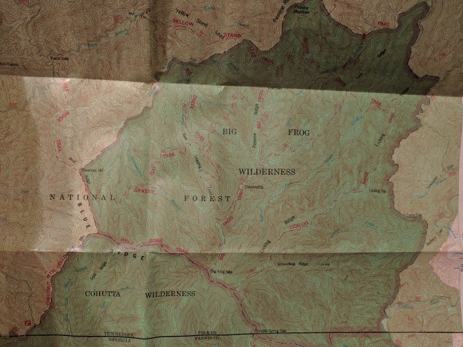
I reached the point where my National Geographic Map 777 was no longer useful, so for navigation I resorted to three things I always carry: my $5 Forest Service map of Cohutta/Big Frog Wilderness, a simple compass and a wristwatch.
For novices to navigating by topographic maps, the trick is to stay ahead of the game. Pinpoint your initial location on the map before you start your journey. Stop frequently and keep track of where you are on the map as you go.
Over time you’ll develop the skill to translate the map’s contour lines into the physical ridges and valleys around you and gain an appreciation for a simple compass. With experience, you’ll also become familiar with approximating the number of miles you can walk in an hour over various types of terrain. It’s a useful habit to keep track of times and mentally tally the distance traveled since your last verified location, as that information tends to calm the spirits upon the realization that you’re lost.
Monday morning was a cool and windy morning. I donned my hiking pants, and I had to wear my rain jacket for warmth while I packed my things. I hung my tent over my clothesline and waited for the damp tent floor to dry out from the previous evening’s rains.
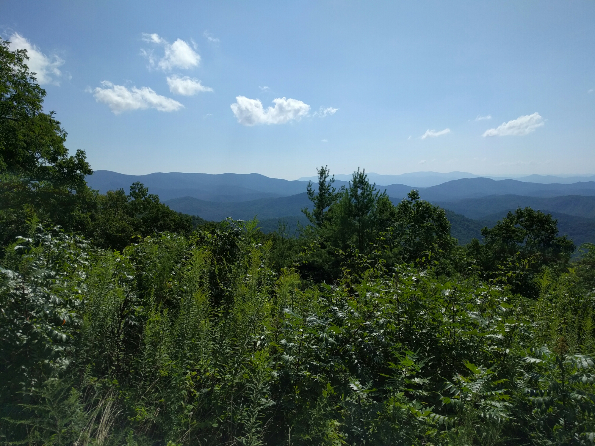
I started my hike relatively late that morning at 9:40, but the cool breezes continued as I hiked down the mountain on Big Frog Trail. The overlooks along the ridge approaching Chimneytop and tunnels created by mountain laurels were the most memorable parts of Big Frog Trail.


By 12:30 I had reached the creek and the junction of Rough Creek Trail and West Fork Trail. I lingered by the water’s edge for awhile, refilling my water bottles, preparing lunch and afterwards, boiling all my dishes and utensils to achieve a thorough cleaning.


By 15:58 I had made it to a very confusing section of Rough Creek Trail at East Fork Rough Creek. I wasted about 20 minutes trying to sort out where the trail was. I finally made the decision to cross the creek and go in a straight line east up a ridge until I hit the trail again.
My decision was right, and by 17:11 I had arrived at the junction of Licklog Ridge Trail and Rough Creek Trails. This section of these two trails was filled with obstacles, and I would not recommend anyone to attempt this area without daylight. The trail was heavily overgrown, and toppled trees forced me to crawl on my hands and knees so many times that I lost count. All the activity of passing through poorly maintained trail caused me to drain my water supply by 2 liters.
I had hoped a campsite was going to be available on Licklog Ridge Trail, but as far as I could tell, no one was interested in this area of Big Frog Wilderness at all. Overheated and wobbly-legged, I eventually arrived back on top of the mountain with the only redeeming event from this trail being the view of a mountain sunset.
I was tired, and I had set up camp without emotion, thought or care for capturing the moment. My best guess is that I was asleep by 23:00.
Day 5 – 30 AUG
Day 5 consisted of hiking 1.5 miles of Wolf Ridge Trail, all of Chestnut Mountain trail (1.9 miles), almost 2 miles Forest Route 62, Beech Bottom Trail (4 miles) and a section of Jacks River Trail (~1 mile). I started the day at 4200′, encountered a few small changes in elevation on Beech Bottom, and ended the day at 1700′.
I had crashed hard in my tent the previous night, but the loud wind rustled the trees and woke me at 2:00. I could hear the wind rolling through the tree foliage like ocean waves, up the ridge of Big Frog Trail and down toward Licklog Ridge Trail. The sky was clear, and I wondered at their secrets while enjoying an immersion in a flow of sound. Every wave seemed to bring a gust of cooler air into my star-filled tent. I invested myself, thoroughly enjoying the moment. After taking in what the night offered, I made a more timely use of my insomnia by cleaning and bandaging a scrape on my left foot.
I eventually felt drowsy again and slept relatively late into the morning. By 9:20 I had eaten a bowl of warm oatmeal, chased with jasmine green tea. I was packed and on a personal mission to refill my water bottles as soon as possible. Having slightly over 0.5 L for my day’s hike did not make me comfortable about lingering atop Big Frog Mountain any longer.


Wolf Ridge Trail started out as an overgrown hazard, requiring footholds to be patiently revealed with the assistance of a stick I had the foresight to carry with me from my campsite. I wondered how long I would have to maintain this slow pace and activity of forcing vegetation out of the way, that is, until a breeze collected all the scents of the flowers I was wading through and wafted a concentrated mountain breeze toward me. I regained perspective with an awareness that the area was buzzing with activity. The combination of the artistic palette of wildflowers about me, the humble sounds of nature at work and the cool morning breeze gravid with a richness of nectar resulted in an experience that cannot be captured in a photo.
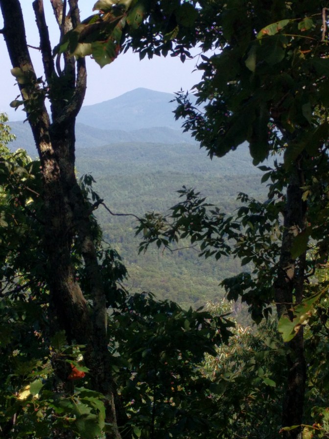
Chestnut Mountain Trail was an easy path, still closely resembling the once passable logging road from which it was established. The ridge view unveiled itself in a few spots, forming naturally framed windows that were filled with the Cherokee National Forest, inviting a distant opportunity.
My plan was to hike to Forest Route 62 to take advantage of a couple of springs en route to Beech Bottom Trailhead. After 3.5 miles of hiking I found the springs, but they appeared to have been dry since the beginning of August. I continued my journey to Beech Bottom Trail being resilient to the cold shoulder from the wilderness.
I should mention that I’ve never left a backpacking trip from the Cohutta Wilderness without finding lost objects. I’ve found the commonly abandoned tent stake, a perfectly functioning can opener, a folding saw, a drunkenly abandoned ax, and even an oddly-placed wheelbarrow. I find some of the items very useful, like the Casio watch that I found last year and continue to use on this trip or a poncho that kept me dry for years after I discovered it. I could go on with stories of hiking poles, fishing rods, fleece blankets, full sets of abandoned clothes and so on, but the main point is that people seem to escape here in the wilderness to the degree that they wind up endeavoring on their journey home partially collected.
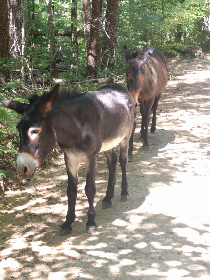
It was no surprise for me to discover lost items on my hike to Beech Bottom Trailhead; however, this was the first time to find objects that I could not carry with me.
- Reason 1: the objects were quite large.
- Reason 2: the objects were animate.
The burro and small horse seemed to be best friends. The burro was the extrovert of the two, casually walking up to me to for an introduction. After an exchange of names and brief discussion of our origins, we all walked along FR 62 together for roughly 10 minutes before I apparently offended them in asking if they’d seen water nearby. The horse (ahead of me at this point) stopped, slowly turned its head to take a long look at me, raised its tail and let me know what it thought of my question. With the answer piled high, the two characters decided it was time to bid me adieu and wandered off into the forest, possibly to their secret watering hole.
I arrived at the Beech Bottom Trailhead at 12:52 waterless, hungry and with a heavy pack of dehydrated food. I remembered that I had packed a packet of ready-to-eat tuna salad just for a moment like this, so I settled down at the trailhead, took off my boots for awhile and rummaged through my pack. After extracting every drop of sustenance and liquid I could squeeze from the foil pack of tuna salad, I set my eyes on a mud puddle with a 1/4″ of water in it. I decided it was time to start walking again.
By 13:43 I had my eyes set on a familiar flowing branch on Beech Bottom Trail. I lowered my pack in gratitude and unzipped the pocket that contained my water filter. It wasn’t there. I checked another pocket and continued my obsessive-compulsive search until admitting that I had failed to collect myself yesterday before endeavoring on my journey up Big Frog Mountain. Yesterday I had stopped for lunch at West Fork Rough Creek, and now with my mind’s eye, I envisioned my abandoned filter on the lonesome waterside rock I had used as a chair.
My water filter was only about 6 or 7 miles away as the crow flies. Is filtration necessary? Are pathogenic microorganisms really in this water? It’s a flowing stream of water, crystal clear and cold. Are there bacteria, protozoa and viruses lurking in there, waiting to attack?
I didn’t have to worry about experiencing the cold shoulder of the wilderness again nor about how much time I had before the likes of E-coli or Giardia (commonly called “beaver fever”) set in. I opened my first aid kit and found my water purification tablets, used as directed and waited patiently for 30 minutes before I could refresh myself. The chlorine taste was reassuring.


By 19:49 I had set up camp and eaten dinner near the junction of Rough Creek and Jacks River. I drank several liters of water mixed with Gatorade powder and several liters without anything to cover up the chlorine taste. I had been thirsty over the past two days, and now my body wanted to recover all the water weight I had lost.
I’ve already written about this particular camp on this trip, near the trailhead of Rough Ridge Trail. The river crossing I took to get here is still deep this time of year, but I know a path that takes me to a shallow area. I snapped a few photos of the crossing point and of the abandoned railroad beds. My $5 Forest Service explains why a railroad was ever here in the first place:
As is true of most of the east, logging played an important role in the history of the Cohuttas. Most of the area was owned by the Conasauga River Lumber Company in the early 1900s. Between 1915 and 1930, 70 percent of the present wilderness was cutover. To remove the logs, an extensive railroad system was built up the Jacks and Conasauga River drainages. Four logging camps, operating simultaneously, housed 80 to 100 men. Loggers built the railway, dynamited rock ledges, and skidded logs with horses. Several miles of wilderness hiking trails are now located on the old railroad beds. Evidence of the railway can still be found.
The Forest Service bought most of the land in this area in 1934 and 1935 and began a long process of rehabilitation. Now, human imprints are virtually unnoticeable.
23:30 – a loud owl pulled me out of my slumber. The call sounded like a more musical version of a woman failing to hold back a sneeze followed by a couple of high hoots, a low hoot and a slide from high to low, finishing with a few low staccato notes.
Day 6 – 31 AUG
Day 6 consisted of hiking from my camp near the junction of Rough Ridge Trail and Jacks River Trail to the Hickory Ridge Trailhead (~1 mile) and hiking the entirety of Hickory Ridge Trail (3.5 miles) plus a large part of East Cowpen Trail (~4.5 miles). I started the day at 1700′, ascended Buckeye Mountain to 3500′ followed by Cowpen Mountain to 4050′, and ended at the Three Forks Mountain Trailhead at 3500′.
In hopes of recovering my water filter that I had absent-mindedly left at West Fork Rough Creek, I drove to the West Fork / Benton MacKaye Trailhead (~35 miles via west side Forest Routes) once I got to my vehicle. Note: A faster east side Forest Route was blocked at FR64 due to mudslides east of Three Forks Trailhead.
5:54 – I had been awake for at least half an hour. The owl had called several more times throughout the night, triggering an intermittent sleep pattern for myself. Even so, I felt well-rested in mind that morning. My sore muscles and hips, on the other hand, warned me that I wasn’t going to get the same use out of them as the past couple of days.
I was focused on recovering my water filter, not because it was irreplaceable or because my life was in threat without it, but because I thought it was undignified to leave a perfectly useful manmade object behind in the wilderness, especially after I’ve traveled with it and respected it for so many years. I made the tough decision to skip Jacks River Falls in order to save some distance and time. I think it’s the first time I’ve been in the Cohutta Wilderness without getting into the natural pool there at the falls, so this decision was not easy for me.
By 8:45 I had eaten my usual breakfast of oatmeal and tea, packed all my belongings and started my hike to Hickory Ridge Trailhead. Hiking the watery morning solitude of Jacks River Trail has always felt peaceful to me, and the only event that took me out of being in this moment was the discovery that I had placed my left hand on pine sap when I was changing from my hiking boots to river-crossing sandals. Nature had suddenly prepared me to catch a 50 yard pass one handed or palm a basketball like a pro. I was seemingly turning into the Human Fly’s worst nightmare, the Human Flypaper.
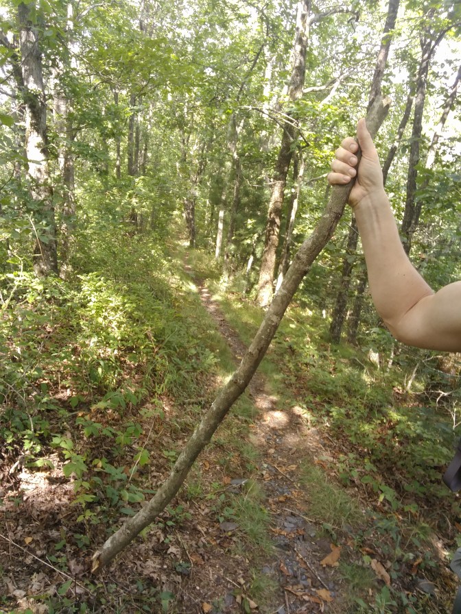
Maybe my newfound powers were foreshadowing the number of spider webs I was to encounter on Hickory Ridge Trail. Although, I had learned my lesson a few days ago and developed a method to protect my sweat-soaked face. I had grabbed a hiking stick, which I named “Spider Stick”. (Note my creativity seems to peak when I don’t have to invest so much of my energy on human interaction). I used its unrelenting powers against an onslaught of webs that morning, swinging it forward as a pendulum in rhythm with my pace.
By 11:12, I was ready to eat lunch. After climbing a little higher with every step I took, my body didn’t care about finding a campsite with proper seating. I sprawled out in the middle of the trail like a mountain troll and ate where I sat.
I stopped many times on my journey up Buckeye Mountain, documenting the best campsites as I went. I made few notes throughout the day, but by 17:07 I had arrived at my car. I relaxed for awhile before driving to the West Fork Trailhead.


The drive took me about three hours, much more than I had anticipated, but I admit that I had failed to calculate the distance in the first place. By the time I found where to park my vehicle to access the West Fork Trail, it was late and about to storm. I decided that the rear of my Transit Connect looked like a safe and comfortable place to sleep that night. I took advantage of the time in my vehicle to repack my backpack, switch out for fresh clothes and drop some weight from my pack.
Day 7 – 1 SEPT
On Day 7 I hiked the entirety of West Fork Trail (2.1 miles), Fork Ridge Trail (1.9 miles) and a section of Big Frog Trail (~1.75 miles). I started my day at 2000′, hiked down to 1750′ and camped at 4150′.
I started hiking at 9:30, full of oatmeal and tea and with a lighter pack, fresh clothes and optimism that my water filter was still on a rock near the intersection of West Fork Trail and Rough Creek Trail. I also decided that regardless of whether my water filter was or was not on the rock where I left it, I was committed to enjoy another day of backpacking.
To build a case for future resiliency, if I were to require it, I kept an awareness about me and began photographing bugs, empty nests and ground plants.


This activity turned into a collection of fungi photographs and photos of living things I could not identify. It did not take long until I was satisfied that I had enough proof (for myself) that I still had my eyes open to nature and I was enjoying the day.


At 10:29 I arrived at scene of the abandoned water filter. It was right where I left it. Even though I was the cause of the whole event, I still felt a victory for completing the journey back to it and recovering it. I captured the event with a few photos and laughed at myself with some familiar song lyrics.
I was a fool to ever leave your side
Me minus you is such a lonely ride
…Reunited and it feels so good


I lingered there next to the creek for lunch, and I took my time hiking the trail. By 15:00 I was at the junction of Fork Ridge Trail and Big Frog Trail, thinking about the campsite I had in mind for the night. It was good that I was getting close to my destination, because at 15:26 thunder was rumbling in the north and a cool breeze started blowing from that direction.
I arrived at my campsite at 16:16 and raindrops started falling about the time I had my tent set up. I had already figured out how to set up my tent in full rain without getting the inside wet, so I wasn’t stressed at all.
The lazy evening gave some breaks in the rain, and I took advantage of them to explore a little more of the area in my rain suit (to avoid a surprise) and eat a good dinner. The sunset showed itself through clouds and trees, and I felt content to be right where I was.
This was the last night of my backpacking trip, and as usual, I tried to review and retain all of my experiences in my memory. Later that evening, I thought about this trip and tried to account for all the things I would miss when returning to my usual life. I challenged myself to list the accomplishments I’ve made during this trip, but I couldn’t find the metrics and milestones that would communicate the value and impact of the healthy perspective I had reestablished.
Quantifying Backpacking
By cumulative miles in perspiration,
Or total change in elevation?
By number of nights under moon and stars,
Or a tally of disruptive hoots and calls?
By the sum of sounds strange in the night,
Or quantity of bears in plain sight?
By flowers and fungi photographed,
Or personal jokes to which I laughed?
By scores of gnats drowned with sweat and tears,
Or records of webs dangling from my ears?
By mountains upon mountains that I’ve seen,
Or sunrise and sunsets that fortify and clean?
By reckoning the days I wish I could stay,
Or simply … by not wishing this solitude away?
Day 8 – 2 SEPT
I hiked out of the wilderness on day 8 via a section of Big Frog Trail (~1.75 miles), Fork Ridge Trail (1.9 miles), part of Rough Creek Trail (~1.5 miles), and another section of Big Frog Trail (~ 1.5 miles). This brought me to the trailhead parking lot. From there I hiked along FR 221 (~1 mile) to return to my vehicle. I started my day at 4150′, hiked down to 1750′ and climbed back up Peavine Ridge to about 2500′.
An incessant and chilly east wind was seemingly directed to crescendo and decrescendo by an unseen conductor. It woke me before sunrise, and I became restless. I started moving about at 5:00, feeling hungry for breakfast. I also had it in mind that if I got on the trail at sunrise, I would beat the heat for my walk out of the wilderness. Even though I was currently wearing my thermal shirt, rain suit and hat to stay comfortable, I knew the temperature was going to rise with the sun.
My food bag was hidden from view of my campsite by a thick fog, so I headed in a straight line toward my best guess at its general direction. The scene – a dense concentration of water droplets reflecting a wall of light from my headlamp, wind carrying fog past with visible velocity – gave me the idea to prepare for an interview with a vampire, just in case. I was probably within 20′ of it before I spotted my food bag. The walk there gave me enough time to become paranoid about whether an animal had pulled my food out of the tree and ran off with it.
Due to the wind, I had to get a little creative in preparing my oatmeal and tea. I placed my stove next to a tree that provided a pretty good windbreak to start with, and then I fortified the break with my food bag, water bottle, my body, and anything else that was mobile and within reach. Even with my attempts to block the wind’s access to the burner, I had to open up the valve on the stove to get the flames high enough to contend with the wind.
At 7:14, I felt there was enough light out to safely start my hike. Since I was only carrying about 1/4 L of water and one extra day of food, the trip down the mountain was going to be the least strenuous yet. By now I had gotten used to starting my hike with only a few strong gulps of water left.


By 7:54 I was at the junction of Big Frog Trail and Fork Ridge Trail. I paused for about half an hour, putting away my thermal shirt and sitting down to write down a few thoughts while eating a chocolate chip Clif bar.
9:03 – While hiking the trail I startled a wild turkey, and the feeling was mutual. It flew off in a commotion, and I did my usual caveman freeze. Back in the 70s Georgia’s wild turkey population was not as healthy as today, so the Department of Natural Resources (DNR) began a restoration program which ended the year I graduated from high school (1996). It’s nice to spot them out in the wilderness, even if we do surprise each other.
9:18 – I removed more layers of clothing and decided to hike shirtless since I didn’t have to worry about shoulder strap burn the next day. I was feeling great, and I’m pretty sure I could have been Rambo’s body double at this point in the trip.
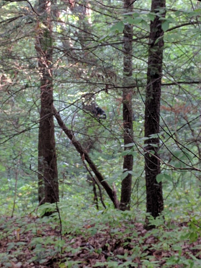
9:30 – I spotted a bear, and it couldn’t decide if it wanted to stay in the tree it was in or come down and run away. I snapped a photo that was on par with any Bigfoot or Loch Ness Monster spotting. My observations have been that over half the bears I see in the mornings are in trees, and most of the bears I see in the evenings are on the ground. So if anyone asks you one morning, “What’s up?” while you’re in the Cohutta & Big Frog Wilderness Areas, there’s a good chance the correct answer is, “Bears”.
The DNR states that there are no recorded bear attacks on humans in Georgia. Hopefully this is due to most people following the simple and logical rule out here: don’t approach or interfere with any animals encountered.
By 10:03 I was filtering water at Rough Creek. I even dared to set my water filter on the same rock as I had previously abandoned it on. I only filtered a couple of liters, because I knew I still had over three gallons of water in my car.
I stopped recording my trip in my journal at this point, but it was past 11:00 when I arrived at my vehicle. I took advantage of the fact that no one was around and freshened up with a shower, shave and fresh clothes so I could blend in with society again. I pulled on my pair of jeans and started buckling my belt, and that’s when I noticed that I needed to take it up a notch.
I weighed myself on my bathroom scale a couple of days later, and I found out that I lost 7 lbs during my trip. Over two weeks later, I still haven’t gained any of this back. I didn’t start out with much fat on my body, but the slow burn of hiking found almost all that I had carried in with me.
WRAPPING IT UP
All of humanity’s problems stem from man’s inability to sit quietly in a room alone.
― Blaise Pascal, Pensées
Blaise Pascal’s quote is one that I’ve carried with me since I found it long ago in my middle school years. I feel it just as strongly now as I felt it then. Although, I would now argue that there’s no need for a room – and there’s no need for sitting. A person can walk quietly and alone outside, falling in love with his or her own meditations while simultaneously satisfying the primal urge to move and explore.
I believe that if you enjoy your solitude, you will carry a strong and healthy internal locus of control. You will create yourself, and you will find your own way. You may also discover that the short story of your origins cannot stop you from writing the larger novel of your future self, one of your own creation.
I receive a range of responses when people find out that I’m backpacking in the wilderness by myself for multiple days. Some people get a worried look on their face and ask probing questions as if they were checking my mental health. (As far as my mental health goes, I do suffer from depression and anxiety, and backpacking has always helped me keep my life in check). Some people create interesting and sometimes offensive conspiracies as to what I’m “actually” doing. Others simply smile and admit to feeling a little envious. I’m thankful for the variety of responses. I know people care about me, yet they may or may not be able to relate to the joy of solo backpacking.
I do not recommend everyone go out in the wilderness for one week straight without any company, neither do I recommend for one to try solo backpacking without any experience. Some people are fearful of being alone and would not fare well in the night. Also, even a simple solo day hike can quickly turn into a nightmare if you are unprepared for sudden changes in weather or injure yourself because you were not familiar with the methods to traverse the terrain. One can easily make it across a river in spring only to return the next day to discover dangerously high and impassable currents. Events such as these must be considered and feed into the development of proper plans.
For those that want to try backpacking adventures, a good outfitter can get you connected to the right resources for your area and set you off on the right foot. A bad outfitter will just try to sell you the most expensive equipment available and send you blindly on your way. I will warn you that there is no need for expensive equipment, especially for your first trips out. Equipment is highly personal, and you will need to learn for yourself what works best for you. My recommendation is to start cheap and start used.
Lastly, if you have not figured it out by now, I am an introvert. Dealing with people all day long seemingly drains the life out of me. When I feel that I can’t escape from the noise, I slowly lose touch with myself. In the wilderness, I feel like I can relate. Most of the animals there seem to have the same agenda as I do: to eat, to sleep and to see another day. Backpacking helps me simplify, reset and rediscover who I am. Backpacking rejuvenates and inspires me.
Sunlight spreads over a face in the shadows
Like the flower of truth beginning to unfold
~ Rumi
EQUIPMENT LIST
I carried all of the equipment listed below on my back, plus some non-essentials that I removed from my pack given the first opportunity. I’ll list what those items were in the Lessons Learned section. Consider this list “improved by experience”, meaning that when I go late summer backpacking again I will be using it as my basis. I prefer not to list brand names, as no one is paying me to advertise their equipment.
| Packs |
| Internal Frame |
| Rain cover for pack |
| Footwear |
| Hiking boots |
| Quick-dry socks (1 + wear in) |
| Sandals (river crossing) |
| Wicking liner socks (1 + wear in) |
| Shelter |
| Sleeping bag |
| 1P Tent |
| Sleeping pad |
| Footprint for tent |
| Inflatable pillow |
| Kitchen |
| Water filter |
| Water purification tablets (backup) |
| Water bottles (4) |
| Stove & fuel |
| Matches/lighters |
| Lightweight pot |
| Utensil (1 spoon) |
| Cup |
| Food |
| Bear bag & cord |
| Pot scrubber & soap |
| Kitchen trash bags (2 is more than enough to pack it all out) |
| Clothing |
| Hat (1) |
| Bandana (1) |
| Wicking underwear (2) |
| Cotton underwear (2) |
| Wicking t-shirt (1 + wear in) |
| Cotton shirt (1) |
| Thermal Shirt (1) |
| Belt (wear in) |
| Trail pants (1) |
| Trail shorts (wear in) |
| Running shorts (1) |
| Ultralight Towel (1) |
| Rain/wind jacket (1) |
| Rain pants (1) |
| Fleece hat (1) |
| Light gloves (1 pair) |
| Lightweight dry bags (2, 13L) |
| Essentials |
| Waterproof first-aid kit: Alcohol preps, antiseptic towelletes, skin tac, ointment, assorted bandages, antihistimines, gauze, tape, elastic bandage, safety pins, nitrile gloves, forceps, duct tape, emergency blankets |
| Watch (wear in) |
| Whistle |
| Compass |
| Map(s) |
| Cord/rope |
| Multi-tool |
| Candles |
| Insect repellent |
| Headlamp (3 AAA batteries) |
| Extra Batteries (3 AAA) |
| Extra light |
| Toilet trowel & toilet paper |
| Hand sanitizer |
| Hygiene kit, including: Toothbrush, toothpaste, floss, soap, ibuprofen, vitamins, lotion, hydrogen peroxide, tweezers, nail clippers, Q-tips |
| Cell phone & charger |
| Optional |
| GPS (2 AAA batteries) |
| Notebook & pen |
| Books: Roughing it in Hawaii & The Soul in Love |
| Baby wipes |
| Paper towels |
| Handkerchiefs (3) |
LESSONS LEARNED
I captured a few notes regarding all the equipment I brought with me. You’ll see some items that didn’t make the revised list above, and unlike the list above, I make a few direct references to brands.
- Sweat bands – seems like a good idea in the summer, but they take too long to dry. An extra bandana is far more useful than a sweat band.
- Carabiners – although not listed above, I have a load of them (about a dozen) attached to my pack. I wouldn’t mind carrying two dozen of these things. They’re so versatile – I found they can even be used as clothespins.
- Cotton clothes – with the exception of one pair of hiking shorts and some night clothes, all of my clothes were quick drying. This was the last trip I will carry anything cotton that could potentially get sweaty and stay wet for two days.
- Sunglasses – I never use them in the wilderness. I don’t know why I always bring them.
- Sunscreen – I prefer to sit in the shade when I’m backpacking, and there’s plenty of it in the Cohutta & Big Frog Wilderness.
- Breathable stuff sack for retired dirty clothes – never a bad idea.
- Utensils (knife and fork) – everything I ate was dehydrated and needed no stabbing or cutting.
- Bowl – don’t need it. A cup works great as long as you learn to eat in serial form. First, eat the oatmeal – second, drink the tea.
- Soap – consolidate all soap to a multi-purpose (like Dr. Bronner’s Peppermint).
- National Geographic maps and UTM coordinates – I’m spoiled by my experience, and I’ll look for these maps when I go backpacking in unfamiliar territory.
- Protein drink mix – I originally carried some protein powder, but it’s so messy to deal with that I don’t think it’s worth the trouble.
- Sewing kit that can repair backpack straps – I almost destroyed my brand new REI Traverse 85 within one week. I had several issues with this bag, returned it and exchanged it for a different one. The REI folks were impressed with my abuse of their name-brand pack.
- Dehydrated meals – buy meals that contain less than 2 servings & look for meals that can be prepared with less than 2 cups of water (e.g, Mary Janes Farm has some great food).
- Always have one wet food option in case you run out of water.
- If dehydrated meals are the only thing you eat, invest in a lightweight water boiler rather than a cooking stove and pot.
- Always check your sleeping mat’s ability to hold pressure before you go camping. I experienced a slow leak, but thankfully it wasn’t so bad as to disturb my sleep.
